
Looking Up Your Laguna Beach Neighbors
A Laguna Beach neighbors lookup starts with the block's physical shape. The city GIS can show adjacent parcels and APNs. OnBase can show address or project files. RecorderWorks can show recorded parties and instruments. A restricted voter file may supply geographic registrants for a permitted purpose. Firewise or neighborhood groups can publish a public leader. Historical directories can show an earlier householder. Each source reveals a different layer, and none is a complete block roster.
| Source | What It Shows About a Block | Access |
|---|---|---|
| City Public GIS | Adjacent parcel geometry, APNs, local layers | Free visual browse |
| Assessor and Recorder | Parcel values, recorded parties, title clues | APN/index; counter or copies |
| OnBase and permits | Dated project roles and address files | Free search; plan-copy limits |
| Restricted voter file | Registrants at addresses when lawfully supplied | Application and permitted purpose |
| Firewise and community groups | Named community and public leader/contact | Public civic layer, no member roster |
| Historical directories | Earlier subscribers or householders | Library, archives, digitized runs |
Owner and occupant are different labels. A tax notice can go to an out-of-area mailing address. A deed can show a trust or entity. A permit can name an applicant or contractor. A public contact can represent a voluntary group. The block method should preserve those roles instead of converting every name into a neighbor.
Laguna Beach's narrow coast and steep canyons make the block frame more useful than a broad ZIP search. Downtown/Village, Woods Cove, North Laguna, South Laguna, Arch Beach Heights, Top of the World, and Laguna Canyon have different development eras and map contexts. A parcel boundary can sit beside a road, association area, or postal label that follows another system. Record the map layer and responsible office before naming the source of a nearby person.
Open the Laguna Beach Neighbors GIS Around One Address
In the Laguna Beach Public GIS viewer, search the target address with the autocomplete, zoom until parcel lines and street numbers are legible, and click the surrounding polygons one by one. Record each APN. Use pan, zoom, identify, select, and layer controls to define the block. If a measurement tool is available, it measures distance or area; it does not set a legal neighbor radius.
Follow each neighboring APN separately into public parcel, project, title, and historic evidence. Do not infer a person from a car, mailbox, map label, or association contact. The city map is the geometry layer, while the county assessor and recorder provide different kinds of parcel and title information. A block map is a research frame, not a household list.
The official public GIS is the first tool for a Laguna Beach neighbors lookup.
Firewise Communities Add to the Laguna Beach Neighbors Record
Recent Firewise recognition creates a useful neighborhood record without creating a member directory. The research names Terrace at Canyon Hills, ABH Laguna, Y Place Fire Safety Organization, and Top of the World Neighborhood Association, with recognition dates from September 2025 through February 9, 2026. Emerald Bay Community Association, North Laguna Community Association, South Laguna Civic Association, and Three Arch Bay add other documented community contacts.
These groups can publish a public leader, contact channel, service area, or preparedness boundary. They do not disclose every participating household. Use a civic contact to understand the block's organized layer, then return to GIS and the record custodian for parcel or dated document questions.
The City's Firewise and neighborhood contact page names the current public civic layer.
Emerald Bay Is a Neighboring Jurisdiction Question
Emerald Bay carries Laguna Beach postal and community identity but is described as unincorporated Orange County between Irvine Cove and Crescent Bay, under Orange County Fire Authority jurisdiction. A block that looks like Laguna on a map may therefore route fire, permit, planning, and records questions to a county or special-district office.
Check the parcel and responsible agency before comparing a neighboring address. Postal ZIP 92651 or 92652 does not decide the city line. The same caution applies to a public association contact: it may explain community geography but does not prove a person's residence.
Map a Laguna Beach Block: Parcels and Owners
Once the target parcel is known, map outward without collapsing the block into one list. The APN is the row key. The situs address is the physical location. The tax-mailing address is the notice destination. The legal description is the title key. Each neighboring parcel should retain its own source, date, and role.
- Locate the address in the Laguna Beach Public GIS viewer and note the target APN.
- Click every surrounding parcel that belongs to the chosen block or immediate map frame.
- Use the APN in the county value tool and recorded-document index, keeping owner, mailing, and title fields distinct.
- Review city OnBase or permit records by address and date for project roles, not assumed occupants.
- For a full named-street chain, switch to the Laguna Beach street directory address walkthrough.
The block method works because geometry narrows the search. It does not create a public list of everyone who lives near the target.
Laguna Beach Neighbors: Groups That Show Leaders
Community organizations are a public-facing layer around a block. The research identifies Emerald Bay Community Association, Terrace at Canyon Hills HOA, ABH Laguna, Y Place Fire Safety Organization, Top of the World Neighborhood Association, North Laguna Community Association, South Laguna Civic Association, and Three Arch Bay. Their published leadership or contact channels can explain a neighborhood boundary, safety project, or civic issue. The City's boards, commissions, and committees roster adds a separate public civic-contact index. A public leader can explain a meeting, evacuation group, or contact route; it cannot certify title, occupancy, or family relationship.
| Terrace at Canyon Hills HOA | El Toro Road and Canyon Hills Drive; Firewise recognition dated September 12, 2025. |
|---|---|
| ABH Laguna | Arch Beach Heights and South Laguna; Firewise recognition dated October 24, 2025. |
| Y Place Fire Safety Organization | Y Place and Loma Terrace; Firewise recognition dated November 24, 2025. |
| Top of the World Neighborhood Association | Top of the World and Old Top of the World; recognition dated February 9, 2026. |
| Other civic groups | Emerald Bay, North Laguna, South Laguna, and Three Arch Bay contacts appear as community resources. |
These are leaders and contact routes, not member rosters. An association's service area may also differ from a parcel, ZIP, evacuation zone, or city limit.
Laguna Beach Neighbors and Restricted Voter Data at Block Scale
California My Voter Status authenticates one person. It does not let a researcher browse nearby voters by address. A lawful voter-file request must state the requester, organization, permitted Elections Code purpose, geography or data selection, format, signature, payment, and supporting documents. Products can include a Standard Voter File, district file, printed pages, customized data, or Master Street File, but purpose limits remain.
Possible public fields include name, residence or mailing address, registration date, status, precinct, district, and whether a ballot was cast. Choices on the ballot, signatures, driver-license or ID data, Social Security information, and full birth dates are confidential. A protected voter may have a withheld address or substitute location.
That restriction is especially important on a small block. A failed personal status check does not establish that a nearby person is absent, and a permitted geographic file still has a defined use. Keep any lawful result tied to its data date, selection, and statutory purpose.
OC Vote's registration services explain the authenticated route for an individual status check.
Compare Official Laguna Beach Neighbors Records With Compilations
Official records and commercial neighbor tools have different strengths. A government portal names the custodian, field, date, and access rule. A compilation may merge names, repeat an old mailing address, or hide the source of a match. The latter can be a clue for a family-history search, but the parcel, deed, permit, court, or library record is what a careful researcher verifies.
| Source | Useful clue | Limit |
|---|---|---|
| GIS and APN | Defines the adjacent parcel set | No occupant list |
| Deed or assessment record | Title party or value context | Owner or mailing address is not occupancy |
| Permit or OnBase file | Dated project participant | Applicant and contractor roles differ |
| Community contact | Public leader or service boundary | No complete membership roster |
| Commercial compilation | Possible name or former address | Freshness and identity matching are uncertain |
Use Laguna Beach Neighbors' Projects for Dated Clues
OnBase and the Tyler-hosted public permit portal can help compare nearby parcels by date. Search the address or APN, open the scanned result, and record the project description, application role, inspection or hearing date, and responsible office. The city can expose plans, permits, inspections, project status, and public-comment material. Copyright and authorization rules govern plan copies.
A narrow California Public Records Act request can ask for an existing address-specific record when a portal stops. The City Clerk is the CPRA compliance office at 505 Forest Avenue, with a Laserfiche request route for records not already in OnBase. The City's public-records procedures explain the agency-side process. The response deadline concerns a disclosure determination, not a promise that every responsive document will be released.
The Laguna Beach public-record request portal supplies the fallback for a dated block record.
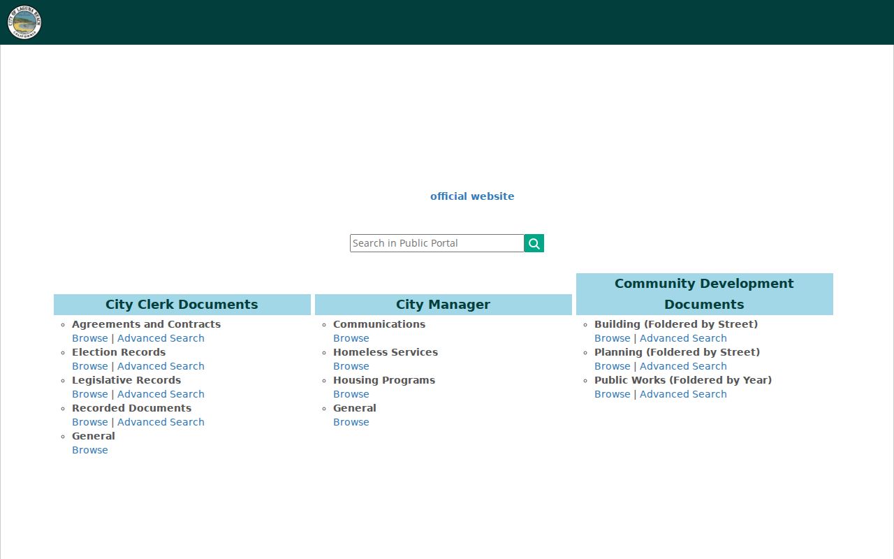
The request channel keeps a block question tied to an identifiable custodian record rather than an invented household list.
Privacy Limits on a Laguna Beach Neighbor Lookup
A neighbor lookup cannot enumerate household members, private utility or delivery customers, DMV addresses, or every participant in a voluntary group. Protected residents may use Safe at Home's substitute mailing address and mail forwarding. The program does not erase every preexisting record, and a protected address must not be reconstructed from map, title, voter, or community clues.
California Penal Code §646.9 covers stalking, §653m covers specified harassing communications, and Civil Code §1708.7 supplies a civil stalking cause. Elections Code §2194 restricts voter-file use. A public name or address remains subject to lawful-use limits even when it appears in an older record.
Lawful use. Laguna Beach neighbors research is for understanding a block, family history, reconnecting with care, and personal safety awareness. Do not use a name, parcel, or address to watch, harass, intimidate, or harm anyone. Verify a sensitive fact with the custodian.